Date: 22 – 23 January 2026
Leaders: Szabolcs Kosik and Callum Rees
The Whanganui Basin (Aotearoa New Zealand) contains one of the most detailed late Neogene to Quaternary sedimentary records of climate change exposed onland anywhere in the world. Over the past 2–3 million years, this area recorded the dynamic interplay of glacio-eustatic sea-level change, regional tectonics, and sediment supply, punctuated by episodes of explosive volcanism from the central North Island. While the basin is widely recognised for its dominantly shallow marine stratigraphy, the role of volcanogenic sedimentation—particularly tephra influx—has increasingly been acknowledged as a significant driver in shaping both its stratigraphic architecture and geomorphic evolution.
Volcanic activity associated with the Taupō Volcanic Zone (TVZ), including the voluminous Kidnappers (1200 km3 DRE) and Whakamaru (2200 km3 DRE) eruptions, profoundly altered the landscape of the North Island. Following such cataclysmic events, drainage networks were disrupted and subsequently re-established, mobilising vast quantities of reworked pyroclastic debris through fluvial systems and into the Whanganui Basin. The volcanogenic sediments resulted in rapid aggradation of valleys, promoting river avulsion, and loading of coastal embayments. These processes, in turn, triggered soft-sediment deformation, slumping, and altered sediment dispersal patterns on the shelf. The basin’s tephra-rich sequences thus provide a unique record of distal landscape response to supereruptions and the cascading sedimentary consequences of volcanism.
During the late Pleistocene, the basin’s evolution was increasingly shaped by regional uplift and climatically driven changes in sediment supply and base level, transitioning toward terrestrial sedimentation. This phase is marked by loess accumulation, fluvial aggradation and incision, and continued tephra input, further enriching the basin’s complex stratigraphic history.
Our field trip will explore this world-class Quaternary sedimentary record to unpack the interplay between sediment supply, uplift and sea level. We will also visit Rātā Marae in the Rangitīkei to learn about the special connection tangata whenua share with this area and witness the magnificent flights of river terraces preserved within the Rangitīkei Valley. We will also provide a history of land use in the area and discuss how geology relates to erosion, presenting questions around land use management and sustainability.
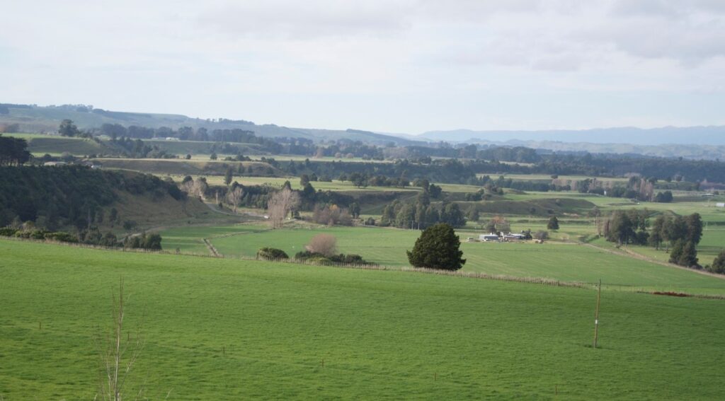
Figure 1: Aggradational river terraces are beautifully preserved in the Rangitīkei River valley, highlighting the interplay between uplift, sediment supply and sea level over the last 350,000 years.
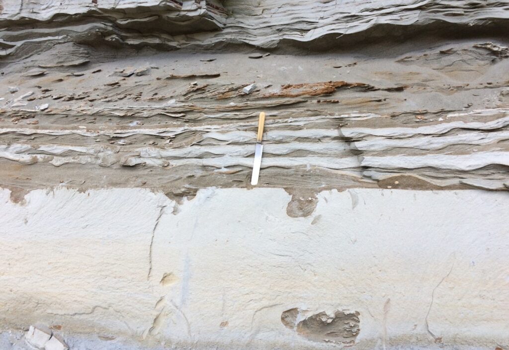
Figure 2: Lenticular, flaser and wavy bedding. Note soft sediment deformation/loading structures exposed in interbedded silts and sands of the Waitapu Stream, Rangitīkei Valley.
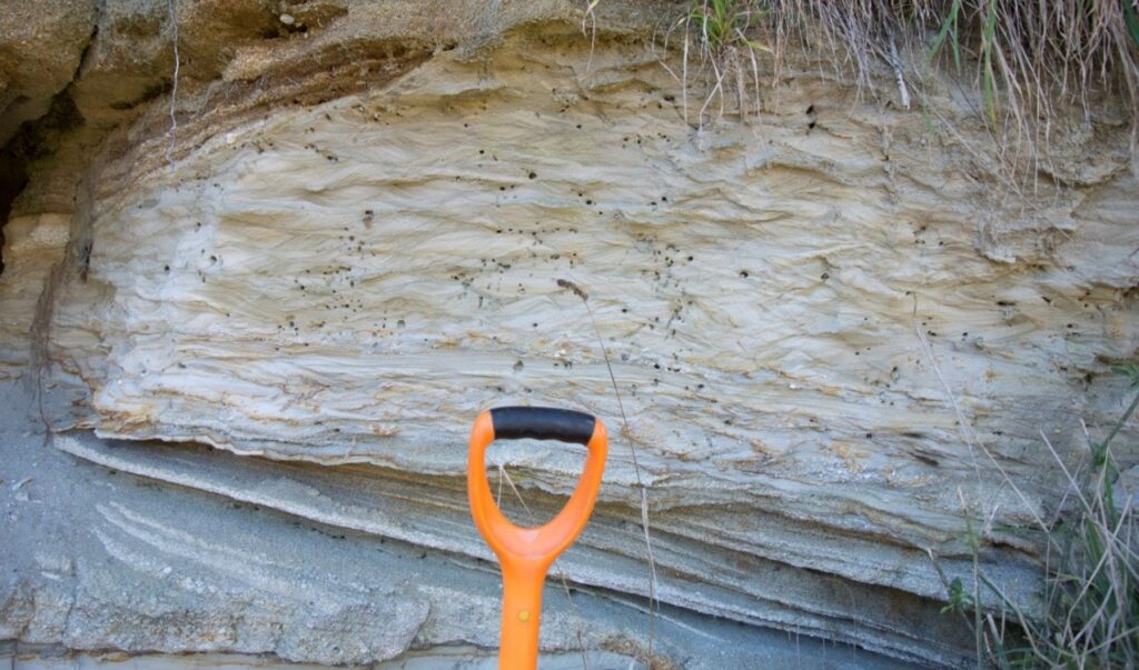
Figure 3: Exquisite ripples preserved within reworked pumiceous sediments of the Kaimatira Pumice Sand Formation (1 Ma), Rātā.
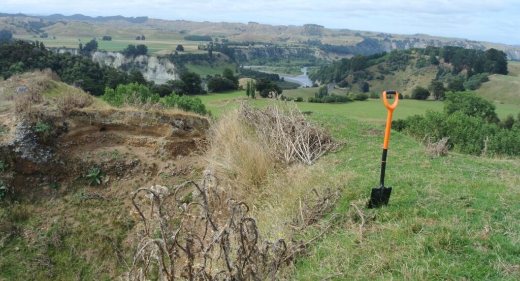
Figure 4: Beautiful scenery and river terraces of the Rangitīkei Valley, Ironworks Road, Ohingaiti.
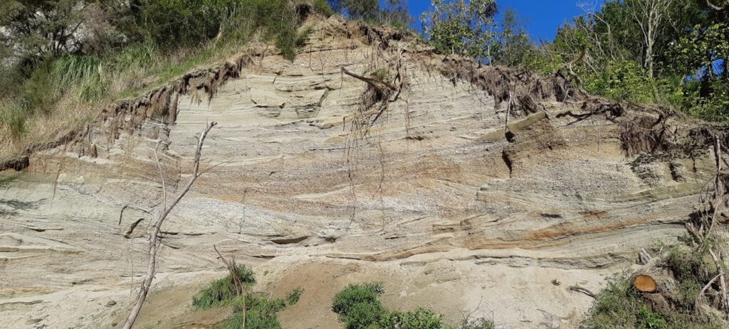
Figure 5: Waitapu cross-bedded pebbly shell conglomerate exposed in Waitapu Stream, Rangitīkei Valley.
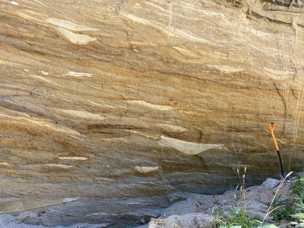
Figure 6: Trough cross bedding preserved within Kaimatira Pumice Sand Formation (1 Ma), Potaka Station, Rangitīkei Valley.
Active Geomorphology from Marlborough to Canterbury – How Faults, Landslides and Sediment Cascades have Shaped Contrasting Landscapes
Full
Date: 31 January – 1 February 2026
Cost ($NZD inc 15% GST): $650-$780 per person
Lacustrine sedimentation – ancient rift fill tectonic control on alternating lacustrine and coal
Full
Date: 31 Jan – 4 Feb 2026
Cost ($NZD inc 15% GST): $1,200 per person
In the Shadow of Mt. Taranaki: Miocene to Recent Deposits from Rivers to the Deep Sea
Full
Date: 31 January – 3 February 2026 (updated)
Cost ($NZD inc 15% GST): Approx $800 per person (+$130 for private accommodation)
Chatham Islands
Contact trip leader
Date: 1 February – 6 February 2026
Cost ($NZD inc 15% GST): Approx $6,000 per person
Distal sedimentation from large-volume silicic eruptions in a regression-dominated marine environment
Date: 22 – 23 January 2026
Cost ($NZD inc 15% GST): $540 per person
Volcano-sedimentary processes around New Zealand’s active andesite and rhyolite volcanoes
Date: 21 – 25 January 2026
Cost ($NZD inc 15% GST): Approx $1,150 to $1,450 per person
Sedimentation on an Evolving Margin
Full
Date: 22 – 24 January 2026
Cost ($NZD inc 15% GST): $650 per person